
GIS Services
Our AMS GIS Team provides services in the following areas:
- Creation of digital maps in ArcGIS Online that can be updated live in the field.
- Creation of paper maps that show assets, physical features, and more, based on client expectations and needs.
- Provide clients with survey-grade location data with our Trimble Catalyst DA2 external wireless global navigation satellite system (GNSS) receiver.
|
Applications, Equipment, and Software
|
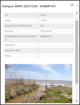
Example of Web App use in the field.
|
|
The Trimble Catalyst DA2 is a tool our GIS Analysts use to collect survey- grade location data for any of our client's needs.
|

Trimble Catalyst DA2
|
|
|